Class IV Lochsa River, ID

Upper Lochsa (White Pine to Fish Creek)

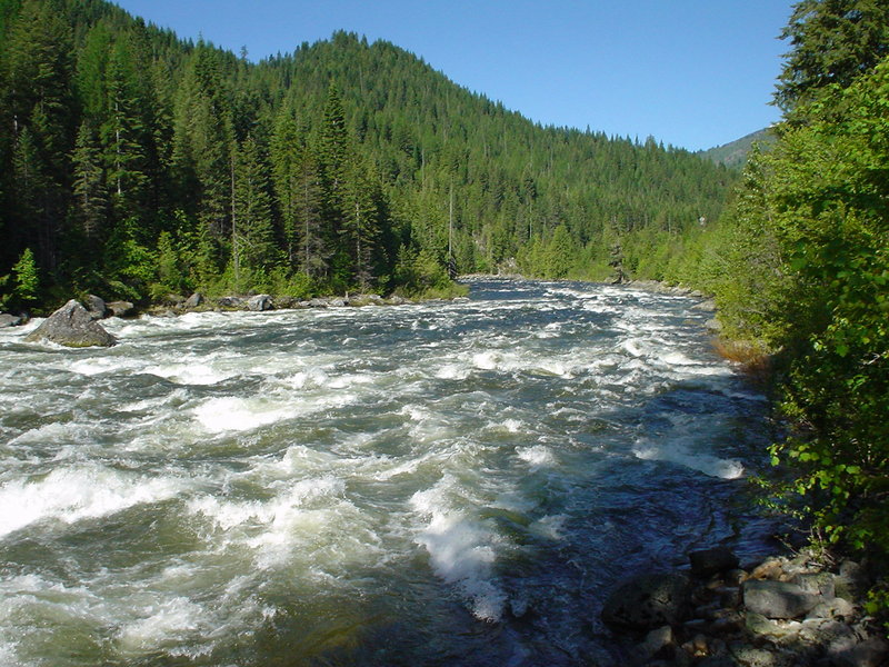
The classic "Upper Lochsa" is a great continuous class IV whitewater run.

The Middle Fork of the Clearwater River System is formed by two main forks, the Lochsa and Selway rivers. These tributaries rise on the west slopes of the rugged Bitterroot Mountains in north-central Idaho and constitute the major river drainage north of the Salmon River.

The exceptionally pure, clear, clean water of this river system and the surrounding forest ecosystem provides a wide variety of cultural, recreational, scenic, historical, and natural opportunities for visitors.

The Lochsa River provides whitewater and scenic floating opportunities, as well as riverside camping and hiking opportunities. The river drops an average gradient of 31 feet/mile with a large number of rapids; the Forest Service has identified 63 Class II or greater rapids within the 64-mile length, with more than half that are classified as Class IV. On the river, kayakers and rafters dominate recreational use during the peak spring and summer floating season.

With many boat launch sites and easy access from Highway 12, there are different options for single and multi-day trips. In the river corridor, there are nine developed campgrounds with 195 camping units. The highway turnouts provide opportunities for boaters to scout rapids and for visitors to pull over to enjoy scenery. Along the Lochsa River in the six miles between Old Man Creek and the Historical Lochsa Ranger Station, five suspension bridges provide foot and stock access via trails to the Selway-Bitterroot Wilderness directly from Highway 12.

Logistics: The put-in is at White Pine at Highway 12 mile 138.5 and the take-out is at Wilderness Gateway Bridge at Highway 12 mile 122.7. For those looking to shorten the run, alternative river access points include Dead Mile at Highway 12 mile 127.5, Department of Transportation Bald Mountain Maintenance Facility at Highway 12 mile 128.4. Nine Mile at Highway 12 mile 129.5, or wherever you find a convenient pull-out along this stretch of river.

While there are several camping options along the entire Lochsa River, including some nice undeveloped sites, Wilderness Gateway Campground, the take-out for this run, at Highway 12 mile 122.7 (cross the bridge to the campground on river left) offers the most sites and is a popular gathering place for whitewater paddlers in the spring.


For More Information Visit:

Lochsa River - rivers.gov

American Whitewater

Section Details

Trip Length Partial Day, 13.0 Miles
Fishing Yes
Camping Yes
Permit No
Manager U.S. Forest Service, Nez Perce Clearwater N.F.
Wild & Scenic Yes
Water Trail No
Partner Information https://www.fs.usda.gov/recarea/nezperceclearwater/recarea/?recid=80042
https://www.rivers.gov/river/clearwater-middle-fork
Description American Whitewater
Photo Credit: Brian Mattingly