Big South (Long Draw Reservoir to Big South Campground)
The Cache la Poudre River is located east of the Continental Divide, in the northern Front Range of Colorado. It is affectionately known as the "Poudre" by local residents and long-time visitors to the area. The main and south forks of the Poudre originate in Rocky Mountain National Park, then flow north and east through the Roosevelt National Forest. The river eventually passes through the city of Fort Collins, then joins the South Platte River east of Greeley.
Visitors to the wild section of the Cache la Poudre find outstanding opportunities for solitude and primitive forms of recreation. Activities include hiking, backcountry camping, fishing, horseback riding, and occasional kayaking for the most adventurous paddlers. The Poudre River Trail extends along the entire length of the river within the park, providing non-motorized access to the remotest reaches of the wild and scenic river designation.
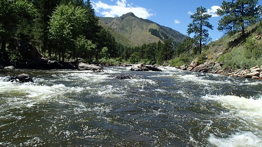
The Poudre River has attracted rafters and kayakers since the 1950's. Rapids on the river are classified from Class I to VI under the International Whitewater Rating System and vary greatly according to water levels. The rafting season generally occurs from May through August.